Category: Land Survey

How Sydney Surveyors Navigate Complex Urban Landscapes

Urban landscapes are constantly evolving, and in a bustling city like Sydney, the role of surveyors has never been more critical. With its unique geography, rich history, and rapid development, Sydney presents a myriad of challenges for surveyors. This article delves into the methods and technologies employed by Sydney surveyors to navigate these complex environments, ensuring that urban planning and construction projects proceed smoothly and efficiently.

The Role of Surveyors in Urban Development

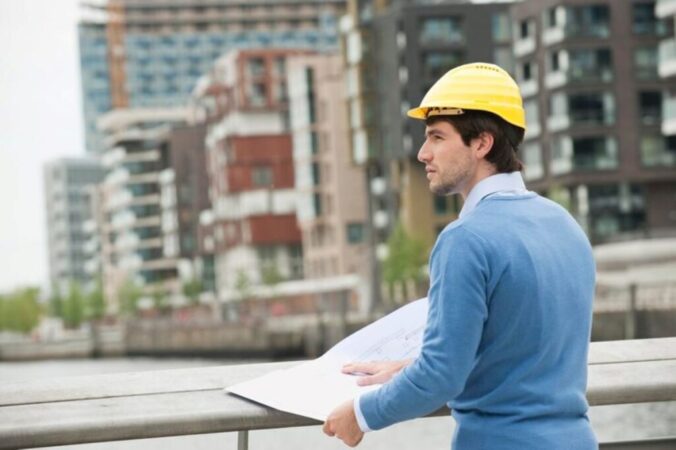
Sydney Surveyors play a pivotal role in urban development, providing essential data and insights that inform planning and construction decisions. They are responsible for measuring land, mapping out boundaries, and ensuring compliance with local regulations. In Sydney, where space is at a premium and the urban landscape is continually changing, the demand for skilled surveyors is ever-increasing.

Understanding Land Use and Zoning

One of the primary responsibilities of surveyors is to understand land use and zoning regulations. Sydney’s diverse neighbourhoods each have specific zoning laws that dictate what can be built and where. Surveyors must be well-versed in these regulations to provide accurate advice to developers and architects. This includes assessing the potential for residential, commercial, or mixed-use developments.

Furthermore, surveyors often collaborate with local councils to ensure that proposed developments align with broader urban planning goals. This collaborative approach helps to maintain the character of Sydney’s neighbourhoods while accommodating growth. In addition to zoning laws, surveyors also take into account environmental considerations, such as the impact of new developments on local ecosystems and community resources. This holistic view ensures that urban growth is sustainable and beneficial for all stakeholders involved.

Topographical Surveys and Site Analysis

Topographical surveys are crucial for understanding the physical characteristics of a site. These surveys map out the terrain, including elevations, slopes, and natural features such as trees and water bodies. In Sydney, where the landscape can vary dramatically, topographical surveys help identify potential challenges and opportunities for development.

For instance, a site located near the coast may require additional considerations for erosion and flooding, while a site in the hills may present challenges related to accessibility and drainage. By conducting thorough site analyses, surveyors can provide invaluable insights that inform design decisions and construction methods. Additionally, these analyses often involve the use of advanced technology, such as Geographic Information Systems (GIS) and 3D modelling, which allow surveyors to create detailed visual representations of the land. These tools not only enhance the accuracy of surveys but also facilitate better communication between stakeholders, ensuring that everyone involved has a clear understanding of the project’s implications.

Technological Advancements in Surveying

The field of surveying has seen significant advancements in technology, which have transformed the way surveyors operate. In Sydney, these innovations have enabled surveyors to work more efficiently and accurately than ever before.

3D Modelling and Geographic Information Systems (GIS)

3D modelling and Geographic Information Systems (GIS) are two technologies that have revolutionised the surveying profession. 3D modelling allows surveyors to create detailed visual representations of a site, which can be invaluable for planning and communication purposes. These models can illustrate how a proposed development will fit into the existing landscape, helping stakeholders visualise the end result.

GIS, on the other hand, enables surveyors to analyse spatial data and make informed decisions based on various factors, such as demographics, environmental impacts, and infrastructure. By integrating GIS into their workflows, Sydney surveyors can provide comprehensive analyses that support sustainable urban development. The ability to layer different types of data—such as zoning regulations, historical land use, and ecological considerations—allows for a more holistic approach to urban planning, ensuring that developments are not only feasible but also beneficial to the community.

Laser Scanning and Drones

Laser scanning technology has become increasingly popular among surveyors for its ability to capture highly accurate measurements of complex structures and landscapes. In urban environments like Sydney, where traditional surveying methods may be challenging due to obstacles and safety concerns, laser scanning provides a safe and efficient alternative.

Drones have also emerged as a valuable tool for surveyors, allowing for aerial surveys that can cover large areas quickly. This technology is particularly useful for monitoring construction progress, assessing land use, and conducting inspections in hard-to-reach locations. The combination of laser scanning and drones enhances the accuracy and efficiency of surveying processes, ultimately benefiting urban development projects. Furthermore, the data collected by drones can be processed in real-time, enabling immediate feedback and adjustments to be made during the surveying process. This agility not only saves time but also reduces costs, making it an attractive option for developers and contractors alike. As these technologies continue to evolve, the potential for even greater precision and efficiency in surveying practices is bound to reshape the landscape of urban development in Sydney and beyond.

Challenges Faced by Sydney Surveyors

Despite the advancements in technology, Sydney surveyors face numerous challenges in their work. These challenges can stem from the city’s unique geography, regulatory environment, and the complexities of urban development.

Complex Urban Infrastructure

Sydney’s urban infrastructure is intricate, with a network of roads, railways, and utilities that can complicate surveying efforts. Surveyors must navigate these existing structures while ensuring that their work does not disrupt essential services. This often requires meticulous planning and coordination with various stakeholders, including utility providers and local authorities.

Moreover, the presence of heritage buildings and sites adds another layer of complexity. Surveyors must be aware of heritage regulations and work within the constraints imposed by these protections, ensuring that any new development respects the historical context of the area.

Sydney Surveyors

Environmental Considerations

Environmental factors also pose significant challenges for surveyors in Sydney. The city is home to a diverse range of ecosystems, and any development project must consider its potential impact on the environment. Surveyors are tasked with conducting environmental assessments to identify potential risks and develop strategies to mitigate them.

In recent years, there has been a growing emphasis on sustainable development, which requires surveyors to incorporate environmental considerations into their planning processes. This includes assessing factors such as biodiversity, water management, and climate resilience, all of which are crucial for the long-term sustainability of urban environments.

See Also : How Sydney Land Surveyors Ensure Accurate Property Boundaries

The Future of Surveying in Sydney

As Sydney continues to grow and evolve, the role of surveyors will be increasingly important. The demand for skilled professionals who can navigate the complexities of urban landscapes is expected to rise, driven by ongoing development projects and urban renewal initiatives.

Embracing Innovation

The future of surveying in Sydney will likely be characterised by continued innovation. As technology advances, surveyors will have access to even more sophisticated tools and techniques that enhance their ability to gather data and analyse urban environments. This may include the integration of artificial intelligence and machine learning into surveying processes, enabling more accurate predictions and analyses.

Furthermore, the increasing focus on sustainability and climate resilience will shape the future of urban planning and development. Surveyors will play a crucial role in ensuring that new projects align with these goals, helping to create more liveable and environmentally friendly urban spaces.

Collaboration and Interdisciplinary Approaches

The complexities of urban development require collaboration among various disciplines, including architecture, engineering, and environmental science. Surveyors will need to work closely with professionals from these fields to ensure that projects are well-coordinated and meet the diverse needs of the community.

This interdisciplinary approach will not only enhance the quality of urban developments but also foster a greater understanding of the interconnectedness of various factors that influence urban landscapes. By working together, professionals can create more holistic solutions that benefit both the environment and the community.

Sydney Surveyors

Conclusion

Surveyors in Sydney are essential to navigating the complexities of urban landscapes. Their expertise in land measurement, zoning regulations, and advanced technologies enables them to provide valuable insights that inform urban development. As the city continues to grow, the role of surveyors will be increasingly vital in ensuring that developments are sustainable, efficient, and respectful of the unique character of Sydney.

By embracing innovation and fostering collaboration, Sydney surveyors are well-equipped to tackle the challenges of the future, contributing to the creation of vibrant, liveable urban spaces that meet the needs of a diverse population.

How Sydney Land Surveyors Ensure Accurate Property Boundaries

Property boundaries are a fundamental aspect of real estate, affecting everything from ownership rights to property development. In Sydney, where urban expansion and development are constant, the role of land surveyors becomes increasingly vital. These professionals utilise a combination of advanced technology, legal knowledge, and practical skills to ensure that property boundaries are accurately defined and maintained. This article delves into the methods and practices employed by Sydney land surveyors to guarantee precise property delineations.

The Importance of Accurate Property Boundaries

Accurate property boundaries are crucial for several reasons. They not only define ownership but also play a significant role in urban planning, construction, and land use. Misunderstandings regarding boundaries can lead to disputes between neighbours, legal battles, and financial losses.

Legal Implications

In Australia, property boundaries are legally recognised and documented. A clear understanding of these boundaries is essential for property transactions, as they determine what land is included in the sale. Any inaccuracies can lead to complications, such as encroachments, where one property owner builds on or uses land that belongs to another.

Furthermore, the legal ramifications of boundary disputes can extend beyond mere financial implications. They may involve lengthy court proceedings, which can be both time-consuming and emotionally draining for all parties involved. In some cases, property owners may find themselves in a position where they must engage in mediation or arbitration to resolve their differences, adding another layer of complexity to the issue. Additionally, the presence of a boundary dispute can affect property values, as potential buyers may be deterred by the prospect of unresolved legal issues.

Impact on Property Development

For developers, knowing the exact boundaries of a property is critical. It influences design, planning permissions, and compliance with local regulations. An accurate survey can help avoid costly mistakes and delays in construction projects.

Moreover, understanding property boundaries is not just a matter of legal compliance; it also plays a vital role in community relations. Developers who respect and adhere to established boundaries are more likely to foster goodwill with neighbouring properties, which can be beneficial for future projects. This respect can lead to smoother negotiations for future developments or expansions, as well as a more harmonious living environment for residents. In an era where sustainable development and community engagement are increasingly valued, ensuring accurate property boundaries can significantly enhance a developer’s reputation and success in the market.

Methods Used by Sydney Land Surveyors

Sydney Land Surveyors employ a variety of methods and technologies to ensure the accuracy of property boundaries. These techniques are continually evolving, incorporating the latest advancements in surveying technology.

Traditional Surveying Techniques

Despite the rise of modern technology, traditional surveying techniques remain fundamental to the profession. Methods such as triangulation and the use of theodolites allow surveyors to measure angles and distances with precision. These techniques have been refined over centuries and provide a reliable foundation for boundary determination. The meticulous nature of these methods often requires surveyors to spend considerable time in the field, ensuring that every measurement is accurate. This hands-on approach not only fosters a deep understanding of the land but also builds a strong connection between the surveyor and the geographical nuances of the area.

Modern Technology in Surveying

Today, Sydney land surveyors utilise cutting-edge technologies such as GPS (Global Positioning System) and GIS (Geographic Information Systems). GPS technology allows for pinpoint accuracy in locating property corners and boundaries, while GIS can be used to analyse and manage spatial data effectively. These tools enable surveyors to produce detailed maps and 3D models of properties, enhancing the understanding of boundary lines. Furthermore, the integration of drones into surveying practices has introduced a new dimension, allowing for aerial surveys that can cover vast areas quickly and efficiently. This not only saves time but also provides a unique perspective that traditional methods may overlook.

Digital Mapping and CAD Software

Computer-Aided Design (CAD) software has revolutionised the way surveyors create and present their findings. Digital mapping tools allow for the creation of highly detailed and accurate representations of land parcels. This not only aids in visualising boundaries but also facilitates easier communication with clients and stakeholders. The ability to manipulate and analyse data within CAD software means that surveyors can quickly adapt to changes in project specifications or client requests. Additionally, the incorporation of augmented reality (AR) into CAD applications is beginning to emerge, allowing clients to visualise proposed developments in a real-world context. This innovative approach enhances client engagement and ensures that all parties have a clear understanding of the project scope and implications.

The Surveying Process

The process of surveying property boundaries involves several key steps, each designed to ensure accuracy and compliance with legal standards.

Initial Consultation

The first step in any surveying project is an initial consultation with the client. During this meeting, surveyors gather information about the property, including any existing documentation, previous surveys, and the client’s specific needs. This stage is crucial for understanding the scope of work and setting expectations.

Field Surveying

Following the consultation, surveyors conduct fieldwork to gather data. This involves physically measuring the land using various tools and technologies. Surveyors will identify existing markers, such as fences or trees, and compare them with historical records to ascertain the true boundaries of the property.

Sydney Land Surveyors

Data Analysis and Reporting

Once the fieldwork is complete, surveyors analyse the collected data. This analysis is essential for producing accurate boundary reports and maps. The final report will include detailed information about the property boundaries, any encroachments, and recommendations for resolving disputes if necessary. This documentation can be invaluable for legal purposes and future property transactions.

Challenges Faced by Land Surveyors

Despite the advancements in technology and methods, land surveyors in Sydney face several challenges that can complicate their work.

Urban Development and Changes in Land Use

As Sydney continues to grow, urban development can alter the landscape significantly. New buildings, roads, and infrastructure can obscure existing boundary markers, making it difficult for surveyors to determine accurate property lines. Additionally, changes in land use can lead to disputes regarding boundaries, particularly in densely populated areas.

Legal and Regulatory Changes

The legal framework surrounding property boundaries is subject to change, which can impact surveying practices. Surveyors must stay informed about any new legislation or regulations that may affect their work. This requires continuous education and adaptation to ensure compliance and accuracy.

Environmental Factors

Environmental factors, such as erosion, flooding, or natural disasters, can also affect property boundaries. Surveyors must take these elements into account when conducting surveys, as they can lead to shifts in land and changes in boundary definitions over time.

The Role of Technology in Overcoming Challenges

Technology plays a pivotal role in helping land surveyors overcome the challenges they face. By integrating advanced tools and methodologies, surveyors can enhance their accuracy and efficiency.

Use of Drones

Drones have become increasingly popular in surveying, providing aerial imagery that can offer a comprehensive view of a property and its surroundings. This technology allows surveyors to quickly gather data over large areas, which is particularly beneficial in urban environments where traditional surveying methods may be hindered.

3D Scanning

3D scanning technology enables surveyors to create highly detailed models of properties, capturing intricate details that may be missed by traditional methods. This technology is particularly useful for complex sites, allowing for precise boundary determination and analysis.

Software Integration

Integrating various software applications can streamline the surveying process. By using software that combines CAD, GIS, and data analysis tools, surveyors can enhance their workflow, reduce errors, and improve the overall quality of their work. This integration allows for better collaboration among team members and clients, ensuring that everyone is on the same page.

Sydney Land Surveyors

Conclusion

Accurate property boundaries are essential for a variety of reasons, from legal implications to successful property development. Sydney land surveyors employ a combination of traditional methods and modern technology to ensure that these boundaries are defined with precision. Despite the challenges they face, the integration of advanced tools and techniques allows surveyors to navigate complexities and deliver reliable results.

Their expertise not only protects property rights but also contributes to the sustainable development of Sydney as a vibrant urban centre. As technology continues to evolve, the role of land surveyors will undoubtedly remain crucial in maintaining the integrity of property boundaries in this dynamic city.

Related : How Sydney Surveyors Navigate Complex Urban Landscapes